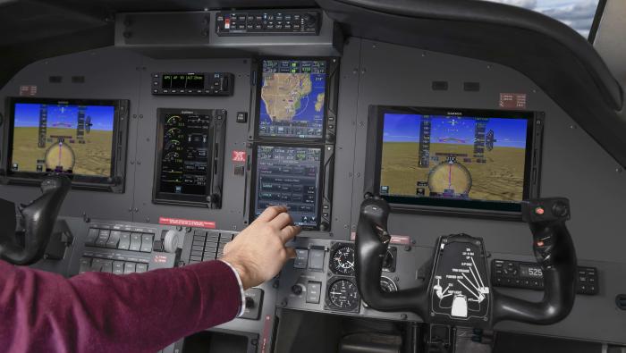
Pilots will finally be able to use pinch-to-zoom gestures on Garmin’s GTN series navigators when a new software update becomes available in August. The free update also adds Garmin’s Telligence Voice Command and integration with the new Flight Stream 510, which enables wireless database transfers.
The Telligence feature requires installation of a separate push-to-command button and also requires the GMA 35/GMA 350 audio panel. Telligence allows pilots to issue voice commands—more than 300 are available—to complete tasks that normally would require a touchscreen or knob input on the GTN.
Commands include asking the GTN to “tune destination tower,” and the tower frequency is then automatically loaded into the standby position. Even if the next hand-off frequency isn’t known, the pilot can simply ask “tune nearest center” and the standby field will then be set to the closest center frequency that might be expected to be the next hand-off. Other typical commands include “create waypoint” to create a user waypoint at the current location; “show distance” to pop up a window with the distance based on flight plan information; or “say distance to destination” for a verbal readout of that distance. Garmin is demonstrating the Telligence features next week at the 2016 EAA AirVenture in Oshkosh, Wis.
“With features like Telligence Voice Command, pilots will feel as though they have a virtual copilot sitting in the seat next to them as the GTN completes tasks via spoken commands,” said Carl Wolf, Garmin v-p of aviation sales and marketing. “These features and more help pilots keep their eyes out of the cockpit by providing a more intuitive, natural user interface that assists them in completing the most important task—flying the aircraft.”
The GTN software upgrade adds other features, including making radios available before engine start, adding a flight track vector, optional clearing of all stored flight plans and waypoints, and pilot-selectable SafeTaxi diagram hot spot descriptions. European operators gain the ability to display visual reporting points on the moving map.